
🌍
English


Tag: maps
(5 extensions)


Revision 14.c (2024-03-29)
- Authors: xbgmsharp, Piwigo Team
- Categories: Plugin
- Tags: maps, gpx
- Available languages: 26 (see)
- Compatible with: Piwigo releases 14
- Downloads: 79485
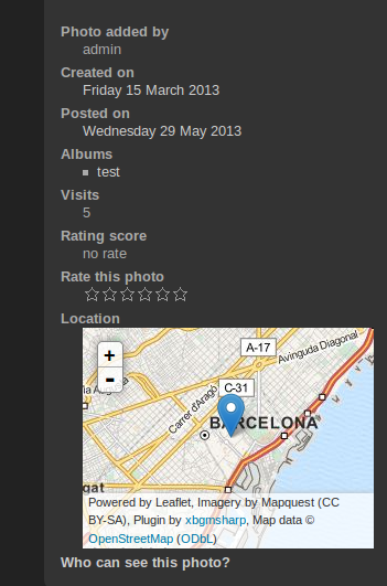
About: Display location information on your web gallery with the only Open-Source worldwide map, created by people like you.
Piwigo-openstreetmap is a plugin for the Piwigo web gallery that allows:
* Display a map on picture page on the right panel
* Display a world map for different view (menu, category)
* GPX support
* Easily find geographical coordinates (latitude and longitude) by click or search
Features of this plugin:
- Easy to use
- Different map styles: Mapnik, MapQuest, OSM
- Custom tile server support
- Pin and Popup settings
- Based on Leaflet -> nice design
Help by translating this extension in your language.
Changes: #252 Warning: [mysql error 1052] Column 'latitude' in where clause is ambiguous

Revision 2.10.b (2018-07-23)
- Author: rvelices
- Categories: Plugin
- Tags: google, maps
- Available languages: 26 (see)
- Compatible with: Piwigo releases 11, 2.10, 2.9
- Downloads: 138615
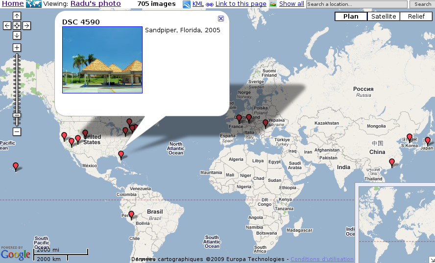
About: Extends Piwigo with geographical location for each photo. View your photos with Google Maps, or open them in Google Earth.
- View by category, by tag, search results or recent pictures.
- Server side clustering of multiple photos, depending on the map bounds and location (to avoid hundreds of markers)
- View all photos in the current map bounds or around a map marker
- Manually set the latitude and longitude on the administration page or synchronize the location with the gps exif metadata
- This plugin does not require any php/template or css code modification, but it does modify the database.
Instructions: Unzip the file in plugins subdirectory of your gallery, then install and activate the plugin from the admin page. Or install from the Plugins menu.
Changes: - compatibility with php7
- language updates
Revision 0.1.3 (2017-09-09)
- Author: TBP
- Categories: Plugin
- Tags: albums, google, maps, mainpage
- Available languages: 6 (see)
- Compatible with: Piwigo releases 2.10, 2.9, 2.8
- Downloads: 11038
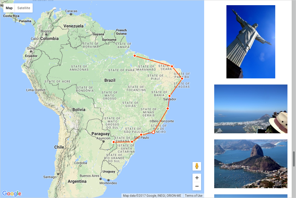
About: Displays your albums on a world map with your itinerary.
Changes: Fix bug about wrong category id on the picture links and use permalinks when availables
 1 review(s)
Revision 2.3.2 (2013-11-06)
- Author: cljosse
- Categories: Plugin
- Tags: maps
- Available languages: 54 (see)
- Compatible with: Piwigo releases 2.5
- Downloads: 54057
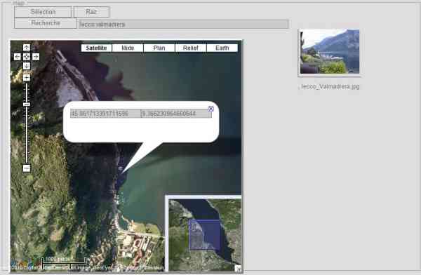
About: - This is an addition to "rv_gmaps" plugin, from rvelices.
- The "rv_gmaps" plugin must have been previously installed.
- "Edit_gmaps" makes it easy to find geographical coordinates (latitude and longitude) of a photo, either by clicking on a map, or by performing a search.
- The coordinates are saved.
Changes: - Correction Bugs
- Ajout languages...(Merci aux traducteurs)
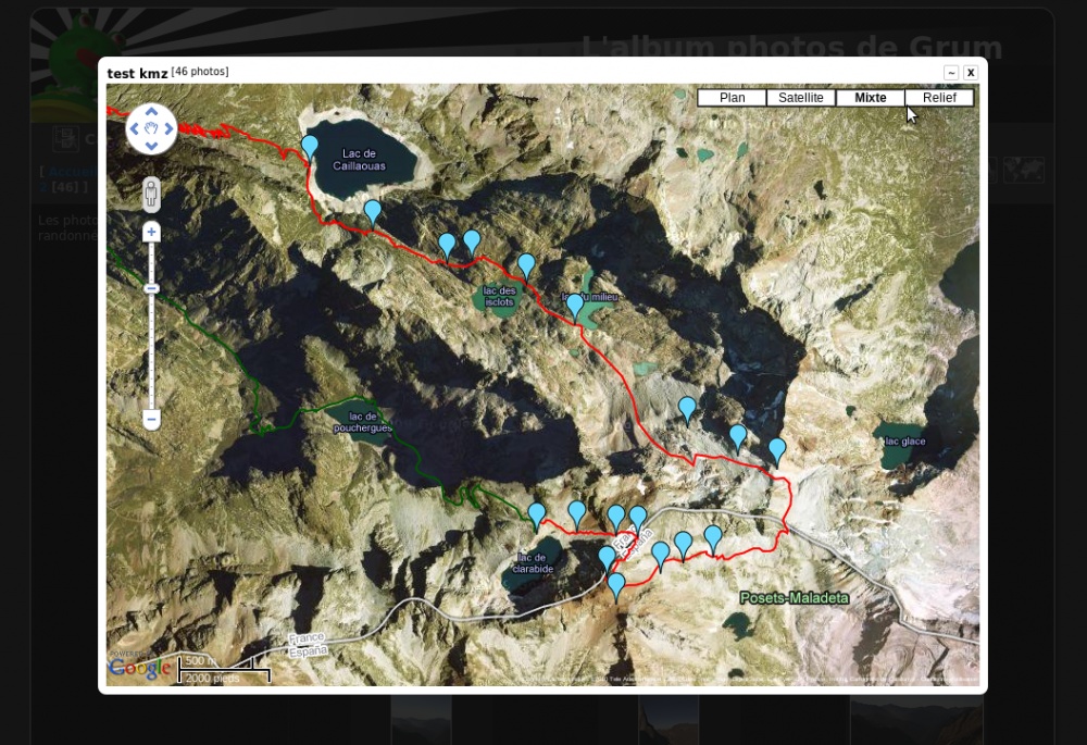
Revision 1.4.1 (2012-08-29)
- Author: grum
- Categories: Plugin
- Tags: maps
- Available languages: 8 (see)
- Compatible with: Piwigo releases 2.4
- Downloads: 23096
About: GMaps displays Google Maps in your gallery:
* Lightbox-style view on the "Category" page
* Lightbox-style view on the "Photo" page
* Display form as metadata on the "Photo" page
- It's possible to configure multiple maps: each map can be set to size, appearance, user controls, etc.
- The maps can be associated with a given category or all of the gallery
- You can also customize the display (markers, overlay KML / KMZ)
- Requires 'GrumPluginClasses 3.5.2' and 'Advanced Metadata 0.7.0' plugins be previously installed
Changes: Bugs fixed:
- bug:2710 => Compatibility with MySQL>=5.1
- bug:2731 => Association between album and map are not always respected for albums with childs albums
(5 extensions)